Roseburn to South Gyle walking, wheeling and cycling improvements (Quiet Route 9)
Feedback updated 23 Aug 2024
We asked
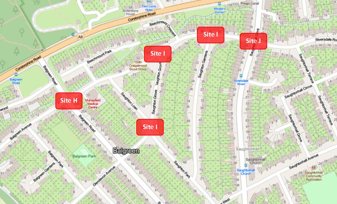
We have been developing designs to improve five junctions along the Roseburn to South Gyle route (Quiet Route 9), focussing on three sites in the Balgreen area - sites H, I and J.
With these improvements we aimed to:
- make the streets safer and easier to use for anyone walking, wheeling or cycling
- connect to other routes in the area, including the City Centre West to East Link and the Roseburn to Union Canal link.
We asked for your views on the proposals to help us shape final designs.
You said
We received 779 responses.
There was support for:
- enhancing crossings for pedestrians and cyclists
- potentially reducing traffic speeds
- enhancing the public realm.
There concerns raised about:
- cost of construction and maintenance
- perceived low priority/necessity of the proposed work
- displacement of traffic to other parts of the neighbourhood
- additional pressure on parking spaces, especially during events at Murrayfield Stadium.
While support did vary, the majority of comments received were either opposed or strongly opposed to the proposed improvements at all three sites.
We did
We have listened to your feedback and taken into account the Our Future Streets: a circulation plan for Edinburgh, which was agreed by our Transport and Environment Committee earlier this year.
With wider plans for improvements along the A8, from Roseburn to Maybury roundabout, we have decided to indefinitely suspend any further work on developing these proposals and re-allocate resources to other projects. The work completed to date will be filed to ensure it is available to support any future developments at these locations.
Overview
The Council is developing designs for improvements along the Roseburn to South Gyle route (Quiet Route 9), which extends west to east between South Gyle and Roseburn Park. The improvements will be in several phases; this first phase focuses on three sites (covering five junctions) in the Balgreen area - sites H, I and J.

The improvements will provide significant value to the local community, benefitting people who live in or work in the area, as well as those travelling through. The work will help to make the streets safer and easier to use for anyone walking, wheeling and cycling and aligns closely with other projects being delivered within Edinburgh, including the City Centre West to East Link and the Roseburn to Union Canal project.
Why your views matter
We have prepared designs for the five junctions and we would like to get people’s views to help us shape the final designs. Please read our FAQ document, which is updated regularly based on common queries we've received to date.
You can view the designs and give us your views by completing the online survey.
The final designs will be used to support an application to Sustrans for further funding for detailed and technical design, which are necessary before applying for construction funding.
Need a different language or format?

Please email the Interpretation and Translation Service at its@edinburgh.gov.uk quoting reference 24-9552A
Areas
- Ward 6 - Corstorphine/Murrayfield
Audiences
- Homeless People
- People with long term conditions
- People with disabilities
- Minority Ethnic groups
- Carers
- Jobseekers
- Low income households
- Older people
- Businesses
- Children & Young People
- Civil and public servants
- Elected Members
- Lesbian, gay, bisexual people, Transgender people (LGBT)
- Men
- Parents/carers
- Professionals
- Residents
- Road users
- Students
- Teaching/Educational staff
- Visitors
- Voluntary sector/volunteers
- Women
- Taxi Licence holders
- Amenity groups
- Architects/designers
- Built heritage groups
- Community councils
- Developers/investors
- Development management statutory consultees
- Development planning key agencies
- Education institutions
- External councils
- Housing associations
- Landowners
- Libraries
- Natural heritage/open space
- Neighbourhood partnerships
- Planning consultants
- Professional bodies
- Scottish Government departments
- Services/utilities
- Transport groups
- Young people
- Licence holders
- Employees
- Licence applicants
Interests
- Cycling and walking
- Roads and pavements
- Road safety
- Travel in Edinburgh

Share
Share on Twitter Share on Facebook