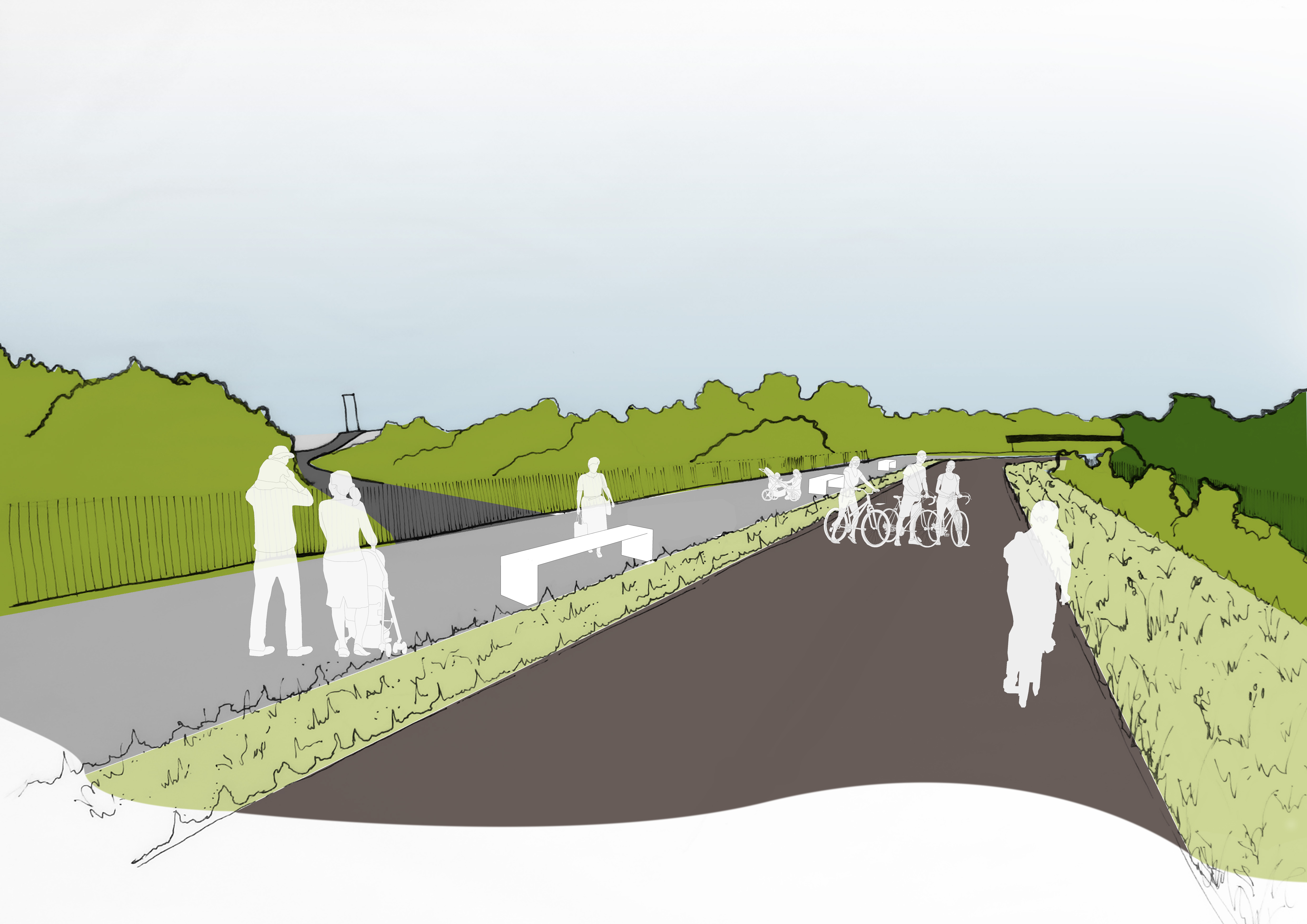
South Queensferry - walking, wheeling and cycling improvements
Feedback updated 19 Dec 2022
We asked
We were keen to hear from the local community about potential ideas for improvements to the streets and landscaping between the Builyeon Road area through Scotstoun Avenue towards Queensferry High School and Dalmeny Station. Our initial study had also identified opportunities to improve the existing routes through Echline and Viewforth towards Queensferry’s historic town centre.
We presented a draft concept design of proposals and sought feedback on these from residents, organisations and businesses.
To publicise the engagement we delivered leaflets within Queensferry and emailed local stakeholder groups. We also promoted the opportunity to give feedback through social media and newspaper website articles.
We held a drop in event in June 2022 for residents to learn more about the proposals and meet the project team.
You said
Proposals across the four areas of the project generally received strong support with 60-70% agreement with the proposals from those that responded to the survey with 11-17% disagreement. From feedback at the drop in event and free text entries in the survey a number of other themes and comments have emerged including:
- ensuring the existing path network is good quality
- concerns about Hopetoun Road and crossings of Bo’ness Road
- concern about the realignment of Builyeon Road
- desire for better access to Tesco
- concerns about traffic from new development
We did
We have now produced a Final Concept Design. We are seeking further project funding to continue with the next stages of design and we will look to incorporate community feedback as the project moves through the next stages of design.
Results updated 12 Dec 2022
Files:
- Queensferry Active Travel Community Engagement Report, 11.8 MB (PDF document)
- South Queensferry Concept Design FINAL, 11.2 MB (PDF document)
Overview
As part of the delivery of the Local Development Plan, we are exploring opportunities for improving walking, wheeling and cycling conditions within South Queensferry. The aim is to create more travel options for your daily trips to school and work as well as other trips in your local community.
The Local Development Plan was adopted in November 2016 and includes detail on the policies and proposals that are to be used in delivering future developments for the city and has identified significant areas of new residential development in the town. We are looking at what improvements are needed to existing infrastructure and what new infrastructure is needed to provide safe and high-quality routes to enable more people to travel in sustainable ways.

We are keen to hear from the local community about potential ideas for improvements to the streets and landscaping between the Builyeon Road area through Scotstoun Avenue towards Queensferry High School and Dalmeny Station. In addition, the study has identified opportunities to improve the existing routes through Echline and Viewforth towards Queensferry’s historic town centre.
Please also see below in the Events section details of our drop in session to come along and see our proposals and provide your feedback.
Within these pages you can also find information on developing proposals for a new shared use path to the south of the high school between Dundas Park and Craw's Close.
Why your views matter
We would encourage you to complete this survey to help us to understand your travel needs and how best to support them through our proposals. We are at an early stage of development of the proposals so are keen to hear from as many voices in the community as possible.
Please see below in the Events section details of our drop in session to see our proposals and provide your feedback.
Data will be handled in accordance with the General Data Protection Regulations that came into effect in May 2018. Data related to this survey is anonymised and will be used solely for the purpose of the Options Appraisal.
Thank you very much for your time in completing this survey.
Events
-
Community Drop In
From 30 Jun 2022 at 15:00 to 30 Jun 2022 at 19:00Come and meet the project team and find out more information at South Queensferry Community Centre, School Lane, EH30 9NU
Areas
- Natural neighbourhood area - South Queensferry/Dalmeny
- Ward 1 - Almond
Audiences
- Homeless People
- People with long term conditions
- People with disabilities
- Minority Ethnic groups
- Carers
- Jobseekers
- Low income households
- Older people
- Businesses
- Children & Young People
- Civil and public servants
- Elected Members
- Lesbian, gay, bisexual people, Transgender people (LGBT)
- Men
- Parents/carers
- Professionals
- Residents
- Road users
- Students
- Teaching/Educational staff
- Visitors
- Voluntary sector/volunteers
- Women
- Taxi Licence holders
- Amenity groups
- Architects/designers
- Built heritage groups
- Community councils
- Developers/investors
- Development management statutory consultees
- Development planning key agencies
- Education institutions
- External councils
- Housing associations
- Landowners
- Libraries
- Natural heritage/open space
- Neighbourhood partnerships
- Planning consultants
- Professional bodies
- Scottish Government departments
- Services/utilities
- Transport groups
- Young people
- Licence holders
- Employees
- Licence applicants
Interests
- Cycling and walking
- Parking spaces
- Roads and pavements
- Road safety
- Travel in Edinburgh
- Biodiversity
- Landscape designations
- Nature
- Parks and green spaces
- Conservation
- Local plans and guidelines
- Planning applications
- Permissions for development
- Area regeneration
- Public space

Share
Share on Twitter Share on Facebook